Hydrodynamic calculation of the Cologne boundary canals on the left bank of the Rhine for Planhorizonte 2030
Coupled modeling in the area of Cologne

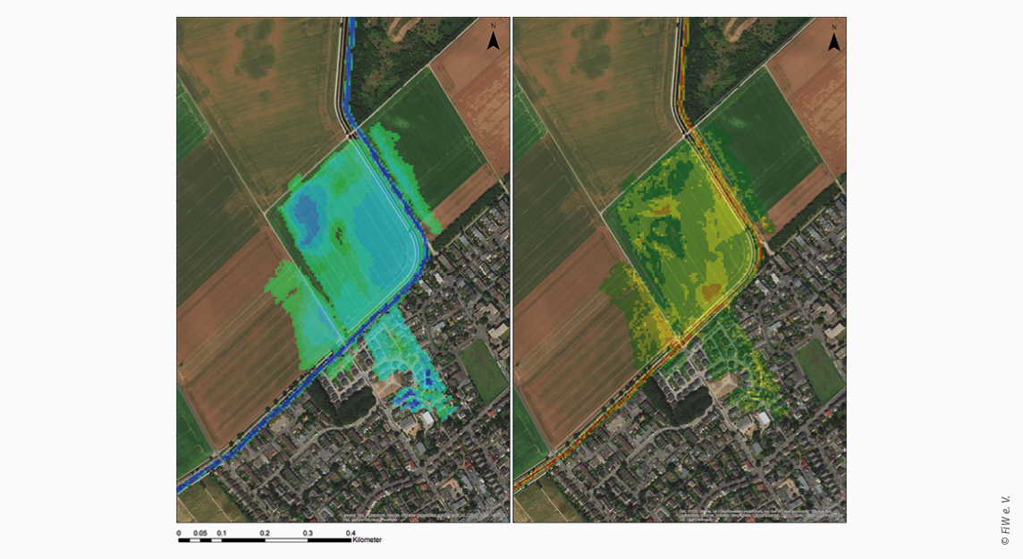
Potential flooding area in the area of the Cologne edge canal made by 2D modelling.
Left: water level [m] (max. >2,1 m), right: water flow velocity [m*s-1] (max. >1,06 m*s-1).
© FiW e. V.

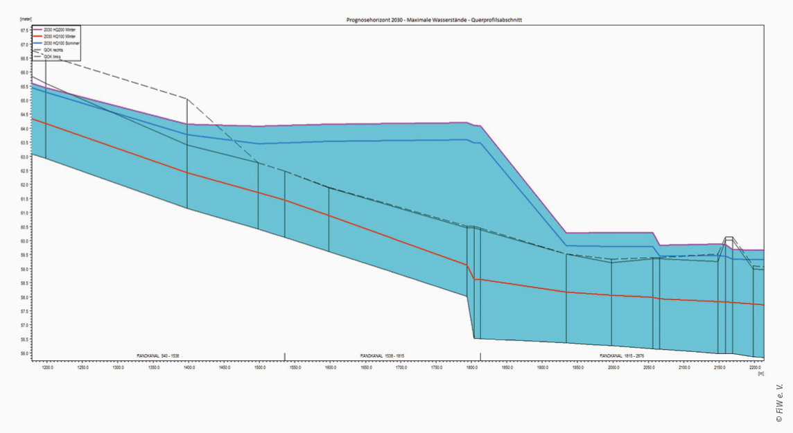
Cross section of the 1D modeling of a station section along the Cologne boundary canal. Comparison of the forecast horizons for 2030 for a one hundred year and a two hundred year summer and winter.
© FiW e. V.
In the context of climate change and urbanisation, it is important to keep the capacity limits of existing drainage systems under continuous review. With regard to the increase in extreme weather events such as heavy rainfall and droughts in combination with increasing land sealing, coupled modelling offers a good opportunity to run through various future scenarios by changing influencing factors.